
IncidentView
100+
Downloads

Everyone
info

About this app
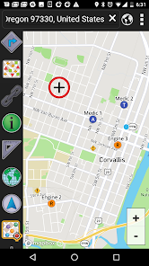
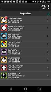
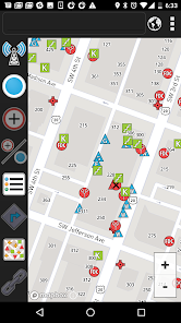
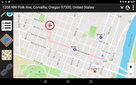
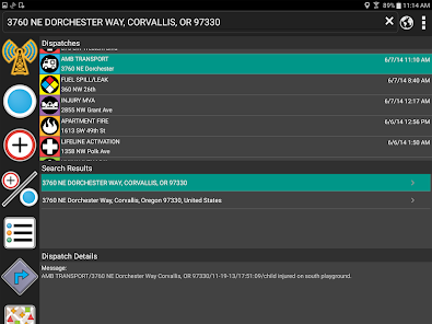
IncidentView is an easy-to-use interactive mapping program designed to present critical tactical information during incident response. The program on Android phones and Tablets and is designed for ease-of-use in a moving vehicle. Large touch screen buttons located along the left side of the program interface window make searching, responding to calls, and viewing infrastructure details fast and efficient.
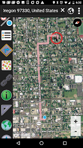
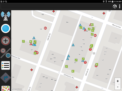
The map is developed using local/regional GIS data added to the IncidentView map as a layer. Layer data used in the application is stored on the hard drive; connection to the internet or a server in not required. Map data is easily updated; data updates can be scheduled as frequently as needed, whenever new data become available.
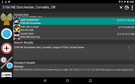
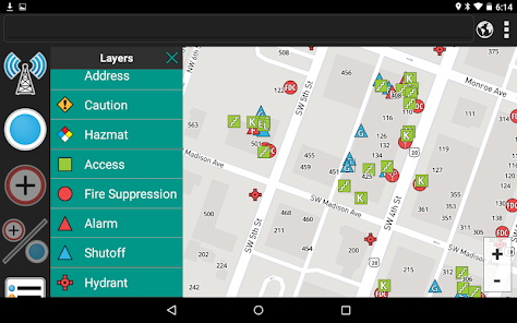
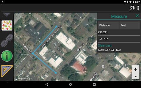
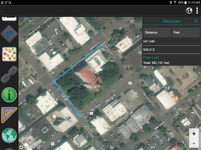
Other IncidentView buttons display hyperlinks to building architectural drawings or other documents, hazardous materials information, etc. Knox boxes, alarm panels, utility shut-offs, water and sewer systems, and other critical information can be added directly to the map. Detailed attribute information stored with your data is easily accessible. Use the Measure tool to quickly measure distances and areas on the map.
The map is developed using local/regional GIS data added to the IncidentView map as a layer. Layer data used in the application is stored on the hard drive; connection to the internet or a server in not required. Map data is easily updated; data updates can be scheduled as frequently as needed, whenever new data become available.
Other IncidentView buttons display hyperlinks to building architectural drawings or other documents, hazardous materials information, etc. Knox boxes, alarm panels, utility shut-offs, water and sewer systems, and other critical information can be added directly to the map. Detailed attribute information stored with your data is easily accessible. Use the Measure tool to quickly measure distances and areas on the map.
Updated on
Data safety
Developers can show information here about how their app collects and uses your data. Learn more about data safety

No information available
What's new
Addressed issue where map fails to display infrastructure layers when the app starts up on certain devices.
App support
phone
Phone number
+15417545034