
The Berlin Wall
4.1star
459 reviews
100K+
Downloads

Everyone
info


About this app
The Berlin Wall separated East and West for 28 years, two months and 28 days. It divided the city, ran through buildings, made streets impassable, tore families, friends and lovers apart. But where exactly did the wall run? The app 'The Berlin Wall' gives a detailed answer. The exact course of the former wall is marked on an interactive map. At historically significant locations between the Brandenburger Tor and Potsdamer Platz, there are photos, audio clips and texts available on the subject. A free data package with further information on places of historical significance throughout Berlin and Potsdam can be downloaded within the app. The app serves as an interactive travel guide on site as well as a general information resource.
Functions
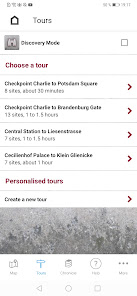
- Overview map with the course of the wall and points of interest (POIs)
- Filter option according to historical locations, escape routes, wall traces, exhibitions and monuments as well as border checkpoints
- Recommended tours along the former wall
- Navigation to the POIs
- Connection to public transport
- Film "Eingemauert! Die innerdeutsche Grenze" (in German)
The app is based on the website www.chronik-der-mauer.de and is a joint project of the Federal Agency for Civic Education, Deutschlandradio and the Leibniz Center for Contemporary History Potsdam. In November 2011, this app won the most prestigious award in the field of political communication, the ”Politikaward”, and in 2012 it received the educational media prize “digita” and the “Comenius EduMedia” label.
Data protection
The app can be used without exposing your personal data. Usage data is exclusively processed in order to provide you with the selected application or service. This information is neither stored within the application nor passed on to third parties.
Permissions
In order to be able to use the Berlin Wall app to the full extent, the app requires access to the following functions:
Location
Precise localization based on GPS data and network information
Is required for:
- Route planning & determination of the position on the map
- Notifications when you are near a POI (explorer mode)
Please note: Continuous background-use of GPS in the can significantly reduce the battery life. (It is used for the explorer mode.)
Internet connection
Show network connection and network access
Is required for:
- Download of data packages, which contain most of the information about POIs & additional tours
- Route planning
- Link to the BVG website (Berlin public transport)
Files & storage
Reading, changing and deleting the contents of your memory space
Is required for:
- Installation of data packages
Developer
chronik@dradio-service.de
Functions
- Overview map with the course of the wall and points of interest (POIs)
- Filter option according to historical locations, escape routes, wall traces, exhibitions and monuments as well as border checkpoints
- Recommended tours along the former wall
- Navigation to the POIs
- Connection to public transport
- Film "Eingemauert! Die innerdeutsche Grenze" (in German)
The app is based on the website www.chronik-der-mauer.de and is a joint project of the Federal Agency for Civic Education, Deutschlandradio and the Leibniz Center for Contemporary History Potsdam. In November 2011, this app won the most prestigious award in the field of political communication, the ”Politikaward”, and in 2012 it received the educational media prize “digita” and the “Comenius EduMedia” label.
Data protection
The app can be used without exposing your personal data. Usage data is exclusively processed in order to provide you with the selected application or service. This information is neither stored within the application nor passed on to third parties.
Permissions
In order to be able to use the Berlin Wall app to the full extent, the app requires access to the following functions:
Location
Precise localization based on GPS data and network information
Is required for:
- Route planning & determination of the position on the map
- Notifications when you are near a POI (explorer mode)
Please note: Continuous background-use of GPS in the can significantly reduce the battery life. (It is used for the explorer mode.)
Internet connection
Show network connection and network access
Is required for:
- Download of data packages, which contain most of the information about POIs & additional tours
- Route planning
- Link to the BVG website (Berlin public transport)
Files & storage
Reading, changing and deleting the contents of your memory space
Is required for:
- Installation of data packages
Developer
chronik@dradio-service.de
Updated on
Safety starts with understanding how developers collect and share your data. Data privacy and security practices may vary based on your use, region, and age. The developer provided this information and may update it over time.

No data shared with third parties
Learn more about how developers declare sharing

No data collected
Learn more about how developers declare collection
Ratings and reviews
4.0
410 reviews

A Google user
- Flag inappropriate
July 23, 2019
NOT TO BE TRUSTED Very first thing it does is tries to do is access all files on your phone. Then crashes when you don't allow it.
11 people found this review helpful

Nicholas White
- Flag inappropriate
July 22, 2023
Requests access to all files and media on my phone, then crashes when I refused permission. Why does a map app need access to my files?
2 people found this review helpful

Francis Shibin
- Flag inappropriate
- Show review history
August 14, 2021
App not opening. I am using Pixel 3A I like the idea. So I will change the review once the issue's been resolved
2 people found this review helpful
What's new
We optimized the tracking functionality and fixed some bugs.


